
Drone Surveys for Buildings in 2026: A Practical Guide
Why Drone Surveys Are Changing Building Inspections in 2026
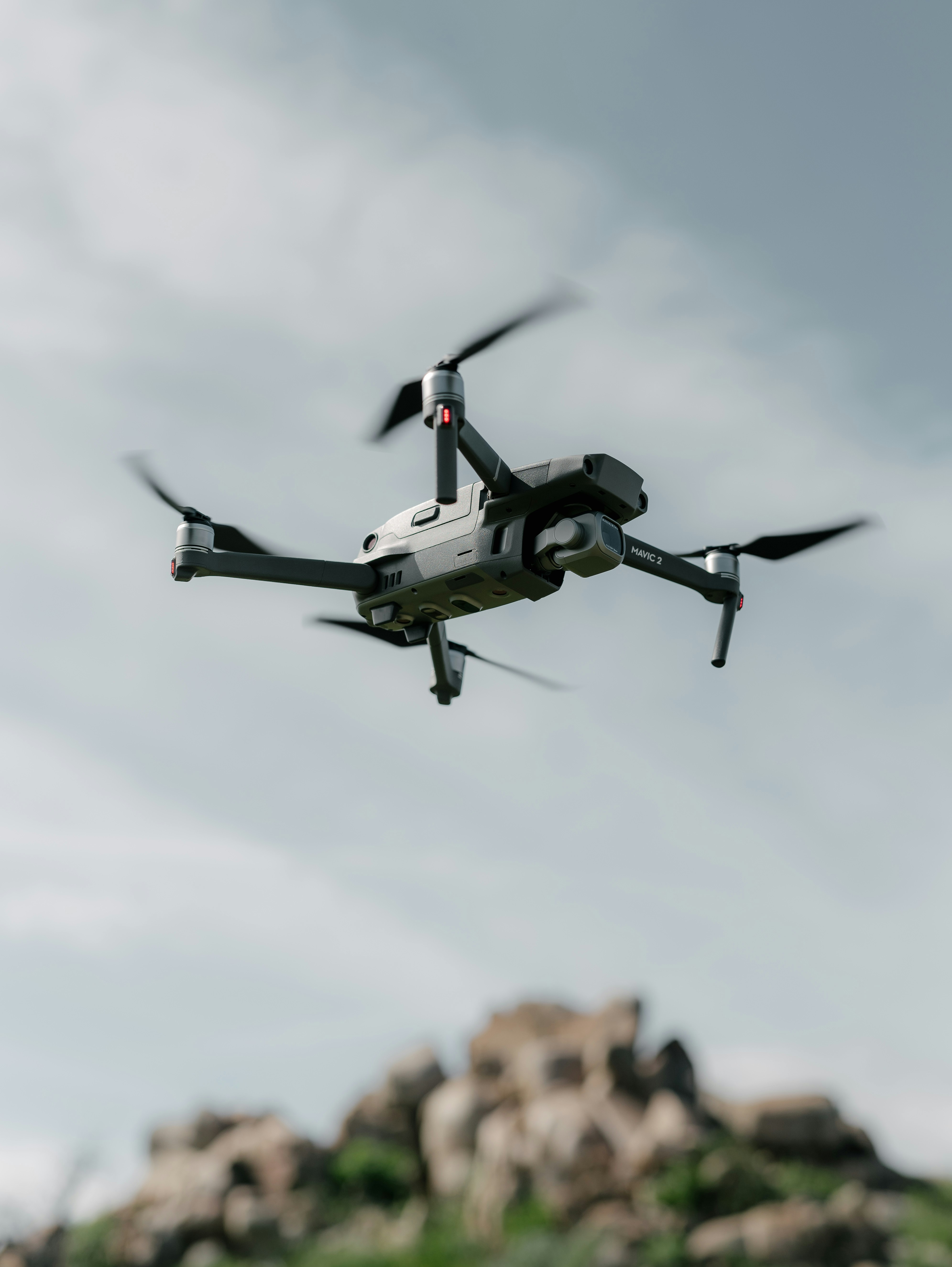
Building inspections have always been a balance between access, time, and confidence in what you are looking at. In 2026, drone surveys for buildings have become a practical way to tip that balance in your favour, especially for roofs, chimneys, parapets, stone façades, and hard-to-reach elevations. The big shift is simple: you can see more detail sooner, with fewer assumptions, and you can do it without putting people in avoidable danger.
For period properties across Cheltenham, Stroud, Tetbury, Cirencester, Gloucester, and into Oxfordshire, access is often the real constraint. Narrow lanes, soft ground, conservatories, and mature planting can make scaffolding expensive or disruptive. A well-planned survey flight gives you a clear, recorded view of condition, which supports decisions on maintenance, repair, and budgeting.
Faster data capture without scaffolding
A drone roof inspection can capture a complete set of roof images in under an hour on many domestic properties, including ridge lines, valleys, leadwork, and flashings. I have found that clients tend to make decisions faster when they can review a consistent set of angles rather than a handful of photos taken from ground level.
For larger sites, the time saving compounds because you can cover multiple elevations in a single session, then review them calmly off site. That speed is especially useful after high winds in the Cotswolds, when you want early evidence of slipped tiles, damaged gutters, or displaced coping stones.
Safer access to roofs and façades
Working at height carries risk even with competent teams and the right equipment, and some locations make safe access slow to set up. Drone surveys for buildings reduce the need for ladders and fragile roof access, particularly on older structures where you do not want to load weakened areas while investigating defects.
A building facade survey drone also keeps inspections controlled in occupied settings, such as homes, offices, schools, or farm buildings. The inspection can be planned to minimise people moving through the work area, and the pilot can maintain a clear exclusion zone while capturing the required details.
Sharper visuals for clearer decisions
Modern cameras routinely capture high-resolution stills that make fine cracks, failed mortar, and lead splits visible on screen at a sensible zoom level. The difference in decision quality is noticeable because you can point to exact locations, then price work based on observed condition rather than a cautious allowance.
When you combine those visuals with consistent capture angles, you also get a baseline for comparison later. That baseline matters for heritage stonework because subtle movement or weathering can look dramatic when described, yet remain stable when checked against properly documented images.
What a Drone Building Survey Actually Delivers (Not Just Photos)
A professional drone survey should leave you with more than a folder of attractive images. The real value comes from outputs that can be measured, compared, and referenced when you are planning repairs, discussing scope with contractors, or compiling records for insurers and stakeholders. In 2026, most clients asking about drone surveys for buildings are looking for evidence they can use, not general impressions.
It helps to agree deliverables upfront because “survey” can mean different things across the industry. Some projects need simple annotated images for a maintenance plan, while others require measurement-ready outputs for design work, tender documentation, or construction verification.
Orthomosaics, 3D models, and measurement-ready outputs
A photogrammetry building survey uses overlapping images to generate an orthomosaic (a scale-corrected map style image) and, where appropriate, a 3D model. When captured and processed correctly, you can take measurements between visible points, which supports quantities, material planning, and clear scope boundaries.
For construction site drone mapping, these outputs can also support site logistics and phasing discussions, particularly on constrained plots. If you have ever tried to explain a complex roof junction over the phone, you will appreciate how quickly a 3D view reduces misunderstanding.
Thermal imagery for moisture and heat-loss clues
Thermal capture can highlight temperature differences that suggest missing insulation, wet patches, or air leakage paths, particularly around roof junctions and dormers. It is not a standalone diagnosis, yet it gives you a targeted list of areas to investigate further with physical inspection or moisture testing.
On older Cotswold properties, thermal imagery is often most useful for identifying inconsistent insulation upgrades and cold bridging around stone walls. In practical terms, it helps you spend investigative time where it matters, rather than opening up finishes on guesswork.
Repeatable progress snapshots for documentation
Repeat flights from similar positions create a reliable visual record of progress, which is valuable for contractors and clients who cannot visit the site frequently. With consistent framing, you can track roof repairs, scaffold strikes, drainage changes, or landscaping work in a way that reads clearly months later.
For occupied buildings, this repeatability also supports dispute avoidance because it becomes easier to show when a defect appeared and what the area looked like before work started. That single benefit often justifies drone inspection services on its own for complex projects.
Best-Fit Use Cases: When Drones Beat Traditional Survey Methods
The strongest use cases are the ones where access is difficult, risk is high, or the building has details that are easy to miss from the ground. In those scenarios, drone surveys for buildings provide evidence quickly and consistently, which supports better decisions about scaffolding, repair priorities, and budget timing. For many property owners, the first drone survey happens after a problem appears, then becomes part of planned maintenance.
If you manage multiple properties across Gloucestershire or Oxfordshire, drones also bring standardisation. You can inspect each building using the same approach, then compare condition across the portfolio without relying on different surveyors’ photo habits.
Roof condition checks after storms
After a storm, the key question is often whether water ingress risk has increased, and where. A drone roof inspection can confirm slipped tiles, missing ridge pieces, displaced lead, and blocked gutters in a single set of documented images, often on the same day the issue is reported.
Speed matters because temporary measures can be targeted. Instead of booking emergency scaffolding “just in case”, you can identify the exact slope and the exact defect, then decide whether a cherry picker, ladder access, or a later scaffold is the sensible response.
Façade and cladding inspections at height
A building facade survey drone is particularly effective for chimneys, parapets, gable verges, and stone details where small defects can become major problems if they progress. You can inspect mortar joints, spalled stone faces, and flashing terminations at close range while keeping people on the ground.
For modern materials, drones help with cladding panels, fixings, and sealant lines where access would otherwise require specialist equipment. The captured record also supports conversations with manufacturers if warranty questions arise later.
Pre-works baselines for planned maintenance
Before any major work starts, a baseline survey reduces the chance of arguments later about pre-existing cracks, staining, or slipped materials. A photogrammetry building survey can provide a measured overview, while targeted close-ups cover known weaknesses such as gutters, abutments, and roof penetrations.
On heritage properties, that baseline also protects the building. You can plan the work sequence with a clearer view of fragile areas, which reduces accidental damage during access setup and material handling.
The Building Survey Workflow: From Flight Plan to Final Report
A good outcome depends on process. When clients are disappointed with drone results, it is usually because the capture was rushed, the deliverables were vague, or the site constraints were not handled properly. A professional workflow for drone surveys for buildings is structured so that what you receive at the end is fit for purpose, whether that is maintenance planning, design input, or documentation.
For properties in busy parts of Cheltenham or tight rural plots near Tetbury and Cirencester, the workflow also needs to account for neighbours, pets, parked cars, and overhead lines. Getting these details right is what keeps a survey smooth and predictable.
Site briefing, permissions, and risk assessment
Before flying, the surveyor should confirm the survey objective, the required outputs, and any site restrictions such as schools nearby, public footpaths, or livestock. A written risk assessment should identify take-off and landing areas, flight boundaries, and how the site will be kept safe for occupants and passers-by.
Permissions depend on location and the operational category, and the surveyor should be clear about what is required from the client. In my experience, the most efficient projects are the ones where site contacts and access times are agreed in writing before the capture day.
Capture day: flight patterns and data quality checks
Capture is not a single flight; it is usually a series of short flights with defined angles, overlap, and distance to the building. For construction site drone mapping or photogrammetry outputs, image overlap and consistent exposure settings matter because they directly affect model quality and measurement reliability.
A competent operator also performs on-site checks, such as reviewing sharpness and coverage before leaving. That simple habit avoids the common problem of discovering gaps during processing, when returning to site costs time and money.
Processing: photogrammetry and deliverable formats
Processing turns raw images into the outputs you will use, such as annotated photo sets, orthomosaics, point clouds, or 3D meshes. The client should know what formats will be supplied, for example PDF reports for easy sharing, plus high-resolution JPEG images for records.
For design teams, it can be helpful to receive files suitable for CAD workflows, provided the capture approach supports that. The processing stage should also include a clear naming structure so that roof slopes, elevations, and defect locations are easy to reference later.
Accuracy, Measurements, and What Can (and Can’t) Be Claimed
Accuracy is where expectations need to be managed professionally. Some drone outputs support reliable measurement for many practical building decisions, while others are primarily visual evidence. The right approach depends on what you need to decide, and how much risk you carry if a measurement is slightly off. In 2026, discussions about drone surveys for buildings often focus on "can I measure it", yet the better question is "what decision will the measurement support."
If you need quantities for a tender, you may require a different setup than if you simply need to confirm that flashing has lifted. A good survey provider will explain this clearly and document the chosen method.
Ground control points vs. RTK/PPK positioning
Ground control points (GCPs) use measured targets on the ground to tie the model to real-world coordinates, and they remain a strong option when you need higher confidence. RTK or PPK-enabled drones use satellite correction data to improve positioning, which can reduce setup time while still delivering robust results for many building survey applications.
On constrained residential sites, GCP placement can be limited by access, planting, or surface type. In those cases, a clear explanation of the positioning method, and what it means for measurable outputs, is part of a professional service.
Typical sources of error: wind, reflections, occlusions
Wind affects stability and can reduce sharpness, particularly when you need close-range façade details. Reflections from glass, glossy cladding, or wet slate can confuse photogrammetry processing, which is why capture settings and flight angles must be chosen to suit the materials on the building.
Occlusions are another practical limitation, where parts of the building are hidden behind trees, parapets, or dormers from certain angles. A careful operator plans additional passes to reduce hidden zones, and they state clearly where full coverage could not be achieved.
Choosing outputs that match your decision needs
If the goal is to plan repairs, annotated images and a defect register usually deliver the best value because they link evidence to actions. If the goal is measurement for design, then a photogrammetry building survey with appropriate control, overlap, and processing settings becomes the priority.
It also helps to separate “nice to have” outputs from decision-critical ones. Clients often request everything at first, then realise they mainly use one clear report with labelled photos and a short list of recommended next steps.
Choosing the Right Drone Survey Partner for Your Building Portfolio
Choosing a survey provider is less about the drone model and more about competence, safety, and deliverable quality. When drone surveys for buildings are used for maintenance planning or project scoping, the outputs need to stand up to scrutiny from contractors, architects, and sometimes insurers. That means you want a provider who is consistent, well-documented, and comfortable working around occupied buildings.
For property portfolios across Gloucestershire and Oxfordshire, reliability matters even more. You want a partner who can return to sites for repeat inspections and provide comparable outputs, so that changes over time are easy to track.
Credentials, insurance, and safety culture checklist
Start with proof of appropriate training, operational compliance, and insurance that covers the type of work being carried out. You should expect public liability insurance suitable for operating around buildings, plus a documented approach to risk assessments and method statements for each job.
Safety culture shows up in small details, such as clear site boundaries, briefing the client contact, and refusing to fly in conditions that would compromise control. A professional provider explains constraints plainly and does not improvise around avoidable risks.
Experience with occupied sites and sensitive locations
Occupied sites require planning around vehicles, neighbours, and daily routines, especially in towns such as Cheltenham where streets can be busy. The provider should be comfortable coordinating access times, maintaining safe separation distances, and communicating clearly with anyone affected on the day.
Sensitive locations can include listed buildings, schools, or sites close to public rights of way. Experience here matters because it affects how the capture is staged, how privacy is respected, and how evidence is recorded without creating unnecessary disruption.
Sample deliverables you should request upfront
Ask to see a sample report that matches your building type, such as stone cottages, larger period homes, or agricultural buildings. The sample should show how images are labelled, how defects are described, and whether the report leads naturally into repair actions.
If you need measurements, request an example of the measurement-ready outputs, along with a note that explains the positioning method used. This is also where you confirm file formats and whether the provider will support your architect or contractor with clarifications after delivery.
Costs, Timelines, and ROI: How to Justify Drone Surveys Internally
Cost is usually discussed as a single number, yet the better approach is to tie cost to outputs and decision value. A basic image-only visit is priced differently from a measured photogrammetry building survey or a thermal inspection, and the time needed for processing can exceed the time spent on site. When you frame drone surveys for buildings as a tool to reduce avoidable access costs and speed up maintenance decisions, the return becomes easier to defend.
For estates and property managers, the main financial benefit often comes from preventing small defects becoming urgent works. The survey itself rarely “saves money” in isolation, but it improves timing and reduces uncertainty in the maintenance plan.
What drives pricing: site complexity and outputs
Pricing is usually driven by travel, site constraints, the number of elevations, and the deliverables requested. A drone roof inspection on a simple domestic property may be straightforward, while a multi-building site with trees, narrow access, and complex roof geometry needs more capture time and more processing effort.
Thermal imagery and measurement-ready models also add processing steps and quality checks. If you want consistent repeat surveys, the provider may also build in time to replicate flight paths and camera angles, which improves comparability across seasons.
Time saved vs. access equipment and downtime
The clearest comparison is often against access equipment costs and the disruption caused by setting it up. If scaffolding is likely to be required only to confirm condition, a drone survey can provide the evidence to decide whether scaffolding is needed at all, and if so, where it should be concentrated.
For commercial buildings, downtime can be a hidden cost. A survey that keeps entrances open and avoids cordoning off large areas can protect normal operations, which makes a strong internal argument even when the survey fee looks significant on paper.
Using surveys to reduce reactive repairs
Reactive repairs tend to be expensive because they happen under time pressure, and they often include temporary measures that would not be necessary with earlier intervention. Regular drone surveys for buildings allow you to spot early signs of failure, such as slipped materials, cracked mortar at parapets, or blocked gutters that are starting to overflow.
If you document conditions every 6-12 months, you can plan targeted work during suitable weather windows and bundle tasks efficiently. Over time, that approach reduces emergency call-outs and improves budget predictability.
Survey type | Typical purpose | Typical turnaround |
|---|---|---|
Visual drone roof inspection | Condition evidence for repairs and quotes | 2-5 working days (depending on report format) |
Photogrammetry building survey | Measurement-ready model and mapped outputs | 5-15 working days (depending on complexity) |
Thermal drone survey | Heat-loss patterns and moisture investigation support | 3-10 working days (including interpretation notes) |
Turning Drone Data Into Decisions: Maintenance, Repairs, and Compliance
Collecting data is the easy part. The value arrives when you convert images and models into actions that reduce risk and protect the building. Well-structured drone surveys for buildings support maintenance plans, contractor scopes, and compliance records because the evidence is specific and repeatable. If you have ever tried to explain a roof issue from a single blurry photo, you will appreciate the difference immediately.
For period properties with stone detailing, decisions often depend on fine condition points. A clear set of annotated images can guide whether work should be carried out by a general contractor or by a specialist stonemason, which directly affects quality and longevity.
Creating a defect register with annotated imagery
A defect register is a structured list that links each issue to a location, a photo reference, and a recommended action. With drone imagery, you can label defects such as cracked flaunching, open joints, slipped slates, or vegetation in gutters, then assign each item an urgency rating.
This approach is especially useful for property managers because it turns a visual survey into a task list that can be priced. It also avoids misunderstandings when multiple contractors are asked to quote, since everyone is looking at the same documented evidence.
Prioritising repairs by risk and exposure
Not every defect needs immediate attention, and drones make it easier to separate cosmetic issues from water ingress risks. For example, a localised slipped tile near an abutment carries a different exposure level compared with a minor ridge mortar crack on a sheltered slope.
By reviewing the imagery with a practical lens, you can prioritise work that protects the building envelope first. This is where professional experience matters, because the best reports connect the defect to the likely consequence if left untreated.
Audit-ready records for stakeholders
Stakeholders often want proof that inspections happened and that issues were addressed responsibly. A dated report with consistent image references provides a clean audit trail for insurers, estate owners, or facilities teams, especially when the building is used commercially.
For compliance contexts, clarity is everything. A concise report, with labelled elevations and a short summary of actions, tends to be more useful than a long document that buries key points across dozens of pages.
How Barrons Building Services Can Use Drone Surveys to Improve Outcomes
Barron’s Building Services sits in a practical position because the business combines building knowledge with hands-on craft skills, including stonemasonry and dry stone walling, alongside survey capability. That matters because drone surveys for buildings are most effective when the person interpreting the evidence understands how buildings are put together, where they fail, and what a sensible repair looks like. For properties across the Cotswolds, that combination can reduce the gap between “survey” and “solution”.
For clients in Cheltenham, Stroud, Tetbury, Cirencester, and across Gloucestershire and Oxfordshire, the benefit is a calmer process. You can move from inspection to a defined scope without repeated site visits and without relying on second-hand descriptions of what the drone found. To learn more about our approach and typical deliverables, see our drone surveys service page.
Integrating surveys into planned maintenance cycles
Planned maintenance works best when inspections are consistent and timed sensibly, such as after winter weather or before major rainfall seasons. Scheduling regular drone surveys for buildings creates a dependable baseline, then highlights change, which helps you forecast repair needs before they become urgent.
For stone properties, this can be particularly useful around chimneys, parapets, and wall heads where water ingress causes gradual damage. A repeatable drone roof inspection every 6-12 months gives you evidence to plan repointing, flashing repairs, or stone replacement at the right time.
Supporting tender scopes with clear evidence
Tender scopes fall apart when they rely on vague descriptions like “check roof and repair as necessary.” Drone outputs allow a more precise scope, with photo references that identify each area and the likely nature of the repair, which leads to more comparable quotes.
For architects and designers, a measured survey output can support early design decisions, especially where existing roof geometry affects an extension or dormer plan. This is also where construction site drone mapping can help on larger plots, giving a clear overview for logistics planning.
Improving client communication with visual reports
Clients make faster decisions when they can see what is being discussed, and that is particularly true for roofs and upper elevations. A structured report with annotated images helps homeowners understand why a repair is recommended, how urgent it is, and what access might be required.
For any inquiries or to explore your vision further, we invite you to contact our professional team.